
This is why we were NEVER Taught this is School: (VIDEO)(LINK)(PDF) Jewish Zionism: Rockefeller and Carnegie Private Foundations Control American School Education
Library of Congress – Worlds Revealed Geography & Maps Tartary
Library of Congress – Detail of Mappe-monde, dressé sur les observations de mrs. de l’Academie royale des sciences et quelques autres et sur les memoires les plus recens.
Guillaume de L’Isle, [1730?]. Geography and Map Division.
Right Click on image and Select “Save Image as” to download image to desktop to view full size.

Library of Congress – Map Tartaria siue magni chami imperivm
Tartaria siue magni chami imperivm. Abraham Ortelius, 1570. Geography and Map Division.
The first edition of Abraham Ortelius’s groundbreaking world atlas Theatrum orbis terrarum, however, includes this dedicated map of Tartaria:
Right Click on image and Select “Save Image as” to download image to desktop to view full size.

The area labeled Tartaria extends from the Volga River and Caspian Sea in the west to the Pacific Ocean in the east, and from Persia and India in the south up to the Arctic Ocean. The map’s depiction of land and coastline is somewhat dubious: among other things, the Korean, Chukchi, and Kamchatka peninsulas are missing entirely, not to mention that North America (including California!) is placed only a stone’s throw from Asia across the non-existent Strait of Anian.
The full title of the mapis Tartariae siue magni Chami regni: “Tartaria or the kingdom of the great Cham.” The map even includes this illustration of the great Cham – or Khan – seated in a tent.
Library of Congress – Detail of Nova et acurata totius Asiae tabula.
Nicolaes Visscher, [1657?]. Geography and Map Division.
The location and extent of Ortelius’s Tartaria means that it was likely intended to represent the Mongol empire. However, by 1570 when the atlas was printed, the Mongol empire had been fragmented for about 200 years. While many Khanates endured, no single “great Khan” ruled over such a large area. The map also includes in Tartaria areas of North Asia which were never incorporated into the Mongol empire. Likely, legends about great rulers and conquests in the great Eurasian steppes influenced the mapmaker’s choice of labels; like all mapmakers, he compiled information from a variety of sources, and some of those sources were more reliable than others.
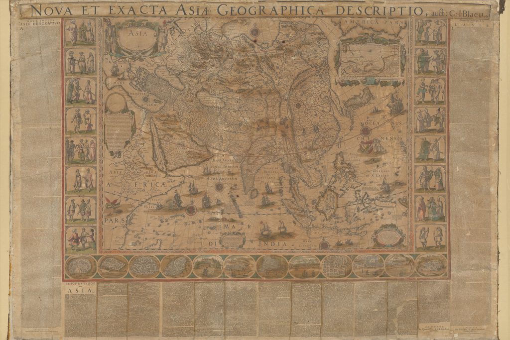
In this “new and accurate map of all Asia” produced by Nicolaes Visscher in 1657, the label “Tartaria” again stretches across most of northern and central Asia. This single large region covers areas inhabited by numerous Turkic peoples, who may or may not have called themselves Tatars. It also included a wide variety of other ethnic groups, including Manchus, Mongols, Tibetans, and many others. The lack of colored regions or borders on this map, unlike Ortelius’s map, reflects the reality that “Tartaria” was not a political designation.
Right Click on image and Select “Save Image as” to download image to desktop to view full size
Library of Congress – Modern Asia
“John Wilkes was a London publisher best known for his Encyclopaedia Londinensis; or, universal dictionary of arts, sciences, and literature (1801-28). Wilkes frequently worked with Samuel John Neele, the engraver of this hand-colored map of “modern Asia.” The mapreflects late 18th-century European geographic conceptions and terminology. India is referred to as “Hindoostan,” while much of the interior is shown as comprised of “Western Tartary” and “Chinese Tartary.” “Tartary” was a designation applied by Europeans to those parts of Asia inhabited by nomadic Turkic and Mongol peoples. This map shows Tartary as stretching from the Caspian Sea to the Pacific Ocean.” World Digital Library.
Right Click on image and Select “Save Image as” to download image to desktop to view full size

Library of Congress – 1757 Carte de Tartarie, also titled Magnae Tartariae Tabula, or “Map of the Great Tartary”
This 1757 Carte de Tartarie, also titled Magnae Tartariae Tabula, or “map of the Great Tartary,” contains a whole mess of Tartaries: “Independent Tartary,” extending east from the Caspian Sea; “Chinese Tartary,” occupying northeast China north of Korea; “Western Tartary,” a label which appears between the previous two; “Eastern Tartary,” north of Chinese Tartary; and across much of the northern region of the map, “Muscovite Tartary.” In the center-west of the map, part of modern Ukraine is labeled “Little Tartary;” in the Caucasus there are “Tartars of Kuban” and “Tartars of Dagestan.” And in the center-north of the map, you find “Tartars of Tumen.”
map of the Great Tartary. Established upon the Accounts of Several Travelers from Various Nations and Several Observations Made in that Country.
Right Click on image and Select “Save Image as” to download image to desktop to view full size

Carte de Tartarie: dressée sur les Relations de plusieurs Voyageurs de différentes Nations et sur quelques Observations qui ont été faites dans ce pais la. Guillaume de L’Isle, 1757. World Digital Library. Original at University of Wisconson-Milwaukee Libraries.
Library of Congress – Central Asia
Tartary continued to appear on European and American maps until the late 19th century. The term is absent from this 1885 map of Central Asia; instead, areas previously labeled as Tartary are now “Turkestan,” “Mongolia,” or “Manchuria,” or identified politically as part of the Russian or Chinese empires.
Right Click on image and Select “Save Image as” to download image to desktop to view full size

“This 1885 map shows Asia from the eastern littoral of the Mediterranean to western China and the Indian subcontinent. An inset in the upper right depicts the region in the broader context of Asia, Europe, and Africa. A focal point of the map is Afghanistan, where, in what was called “the Great Game,” the Russian and British empires competed for influence throughout most of the 19th century. The British feared that the Russians, who annexed large parts of Central Asia in the 1860s and 1870s, would use Afghanistan as a base from which to threaten British India. The central region of Arabia is described as “uninterrupted desert from Mecca to Oman.” The map has two distance scales, one in English statute miles and another in Russian versts. Intended for American audiences, it also shows, at the bottom center, the U.S. states of Indiana and Ohio, which are drawn to scale as a way of comparing distances in the region with those in the United States. The map was issued by the G.W. & C.B. Colton Company, which was owned by George Woolworth Colton (1827-1901) and Charles B. Colton (1832-1916), the sons of Joseph Hutchins Colton (1800-93), founder of the pioneering map publishing firm J.H. Colton & Company.” World Digital Library.
